Educational Resources
Lesson Plan Suggestions
The following lesson plan suggestions offer guidelines for a comprehensive learning experience. Also browse our online activities page for real-time adaptation to your teaching strategies. Please feel free to modify according to your needs.
1. Discuss with your students what a volcano is, and how it forms. Bandera Volcano is a cinder cone. Compare it with volcano like as Mt. St. Helens and others. Do you students know what a lava tube is, and the various forms of lava such as AA and Pahoehoe?
2. View video tapes that illustrate mountain building and volcano formation. One such video tape available from the U.S. Geological Survey is the "LIVING ROCK". Another video tape would be our own "LAND OF FIRE AND ICE", available special to teachers for $7.50.
3. A field trip to the Ice Caves is also an outstanding nature walk. Do your students recognize the difference between Ponderosa Pine, Pinon Pine, Douglas Fir, and Juniper trees? The area also has abundant wild life, and you may see squirrels, chipmunks, blue jays, woodpeckers, and other wild life common to the New Mexico high country.
4. The Ice Cave is rich in culture as well. Indian ruins and artifacts dating back 800 - 1200 years to the Anasazi are visible along the trails and in the Trading Post Museum. Sheep, Cattle, Railroading, and Logging also played an important part in the early days of the Ice Cave. Discuss the history of the area with your students, and the important part the Ice Cave may have played for the early settlers in the area.
5. Be sure and have your students explore all aspects of our web site. Have them click on all hot images to bring up additional images and information about the Cave and Volcano. For example, do you recognize the well known mountain seen behind Bandera Crater after clicking the volcano view on our home page?
6. Make use of our On Line Activity section to measure the trails to Bandera and the Ice Cave. Other features to measure include the width of the cinder cone, length of the Lava Tube, and the area of the lava flow below Bandera. If you are familiar with NIH Image, you can set scale and do your measuring on the computer.
7. Discuss ahead of time the Field Trip Data Sheet provided for you on our web site. This data sheet may be printed out and copies made for students to fill in while on the field trip.
8. Search the Internet for web sites dealing with volcanoes. Listed below are the addresses of some volcano related sites:
Field Trip Data Sheet
This data-sheet provides structure to the field-trip experience. Students are encouraged to use this sheet to take notes for use in later assignments. A downloadable PDF is available at the "Download" link below. Feel free to modify to suit your teaching needs. An answer key is available to teachers upon arrival, by regular mail, or by our contact page.
Bandera, the largest volcano in the Ice Caves region, erupted about 10,000 years ago. There are about 29 volcanoes in the area, and many can be seen in the distance when walking the Bandera trail. How many volcanoes can you see?
Bandera Volcano is called a cinder cone? How does a volcano like Bandera form?
What were the two stages in the eruption of Bandera Volcano?
Do you know the depth, width, and elevation of Bandera Volcano?
Bandera poured out a tremendous lava flow. The satellite view at right may give you some clues. How long is the total length of the Bandera flow?
The type of lava found in the Bandera Flow is called? How does this kind of lava flow form? How do you think this name originated? See picture at left.
The Ice Cave is located in a part of the lava flow called a lava tube? Hot molten lava can reach temperatures above? How does a lava tube form?
See a portion of lava tube at right. The length of the Bandera lava tube, considered to be one of the longest in North America, is about ?
There are many rugged formations in the lava flow. The formation seen in the picture here at left is called a? Do you know how it formed?
The lava flow is called El Malpais in Spanish. What does El Malpais mean?
The Ice Cave, located in a portion of the collapsed lava tube, remains frozen all year.This means that the temperature never goes above?
One of the reasons the ice in the cave remains frozen is that the lava acts as an?
Another reason the ice remains frozen has to do with air flow. See below. Violet is warmer air, light blue is cooler air. How could the air flow into the cave vary from winter to summer?
See at left, scientists coring the ice floor. The depth of the ice floor is about? The ice wall was probably caused by? Removal of ice from the Ice Cave was stopped in 1946. What has been happening to the floor ever since?
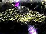
What two forms of plant life thrive near the entrance of the the cave? The green tint of the ice is caused by an? Why are these plants so unusual to the Southwest? See below.
The Ice Cave was known to the Pueblo Indians as the? The ancient Indians who used the cave were the?
The ruins, pottery, and artifacts found near the Ice Cave date the ancient Indian use of the area to about? See above.
The Ice Cave area is rich in flora. Can you identify the 6 major trees found along the trails?
One of the oldest trees in the lava is a? The age of this tree is? How old do some of the other trees of the area live to be?
The Ice Cave area is also rich in wildlife. List below the animals you see during your field trip.


Post Field Trip Quiz
This quiz is provided as a comprehensive followup assignment. It may be printed out as is, or modified to suit your teaching strategies. Answers to this quiz can be found during a field trip, in the Ice Caves Trail Guide, in our video, and on our web site. An answer key is available to teachers upon arrival, by regular mail, or by our contact page. Click the "Download" button below for a direct link to the PDF.